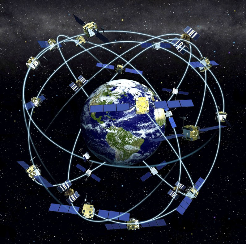
To appreciate Elizabeth's pioneering work one needs an overview of GPS, while on this page an account is given of the GPS satellite constellation system, and brief explanation how and why the ionosphere interfere's with the use of GPS
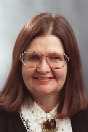
 Elizabeth Annette Essex was born 1940 in Grafton, NSW,
where the world's first female radio-astronomer -
Ruby Payne-Scott had been born in 1912.
She attended the co-educational Grafton High School, before completing a physics degree at the University of New England (UNE),
in Armidale NSW. She stayed at UNE to complete a PhD, to become
the fourth woman to gain a PhD in Physics in Australia.
In her PhD and throughout her career she studied the physics of the ionoshere -
the always moving band of ionised gas (plasma) that surrounds the earth. The ionosphere
greatly influences
the transmission of radio waves, and in fact makes possible short-wave radio.
Her PhD research (see her PhD
thesis abstract) had involved bouncing radio-waves off the underside of the ionosphere,
effectively determining the (variable) change in height.
From 1969 at La Trobe University she began to
study on the earth's surface the features of radio waves emitted by satellites -
termed beacon satellites.
She used a rotating aerial to determine the polarization plane from the geostationary satellite
ATS-1 and hence could determine the Total Electron Content (TEC) along the radio path to the
beacon satelite. This lead to her participation in the first international beacon satellite
conference in Graz, Austria in 1972
In 1973 she attended a conference on beacon satellites held in Kyoto, Japan, where,
notably she met US Air Force scientific staff interested in the reception of radio signals from satellites.
Subsequently she received an invitation to work during 1974 with Jack Klobuchar,
of the US Air Force at a research lab located on a US Air Force Base, Hanscom Fields, located just outside Boston.
This research lab -- late in 1974 - was designated the US Air Force Geophysical Research Laboratory (AFGRL)
Elizabeth Annette Essex was born 1940 in Grafton, NSW,
where the world's first female radio-astronomer -
Ruby Payne-Scott had been born in 1912.
She attended the co-educational Grafton High School, before completing a physics degree at the University of New England (UNE),
in Armidale NSW. She stayed at UNE to complete a PhD, to become
the fourth woman to gain a PhD in Physics in Australia.
In her PhD and throughout her career she studied the physics of the ionoshere -
the always moving band of ionised gas (plasma) that surrounds the earth. The ionosphere
greatly influences
the transmission of radio waves, and in fact makes possible short-wave radio.
Her PhD research (see her PhD
thesis abstract) had involved bouncing radio-waves off the underside of the ionosphere,
effectively determining the (variable) change in height.
From 1969 at La Trobe University she began to
study on the earth's surface the features of radio waves emitted by satellites -
termed beacon satellites.
She used a rotating aerial to determine the polarization plane from the geostationary satellite
ATS-1 and hence could determine the Total Electron Content (TEC) along the radio path to the
beacon satelite. This lead to her participation in the first international beacon satellite
conference in Graz, Austria in 1972
In 1973 she attended a conference on beacon satellites held in Kyoto, Japan, where,
notably she met US Air Force scientific staff interested in the reception of radio signals from satellites.
Subsequently she received an invitation to work during 1974 with Jack Klobuchar,
of the US Air Force at a research lab located on a US Air Force Base, Hanscom Fields, located just outside Boston.
This research lab -- late in 1974 - was designated the US Air Force Geophysical Research Laboratory (AFGRL)
 At AFGRL in 1974, she worked with future Institute of Navigation Fellow,
Jack Klobuchar, USAF physical
research scientist, who was developing the gamut of
ionospheric corrections
for GPS that enable centimeter precision. During her 1974 period at AFCRL she was given the task of plotting the path of radio waves emitted
by low earth orbitting satellites. The USAF supplied a civilian contractor to perform the programming for the plotting while Elizabeth
set up the actual calculation framework.
Using then extant knowlege of the (time-variable) plasma density -- the curved path of rays could
be determined as they progressed to the Earth's surface. This work - known to this writer as the
civilian programmer would regularly visit Elizabeth off-base to show latest plots -- was never
published in the scientific literature; but was used to validate satellite constellation design
for which at least 5 satellites had to be visible at (almost all) points of the Earth.
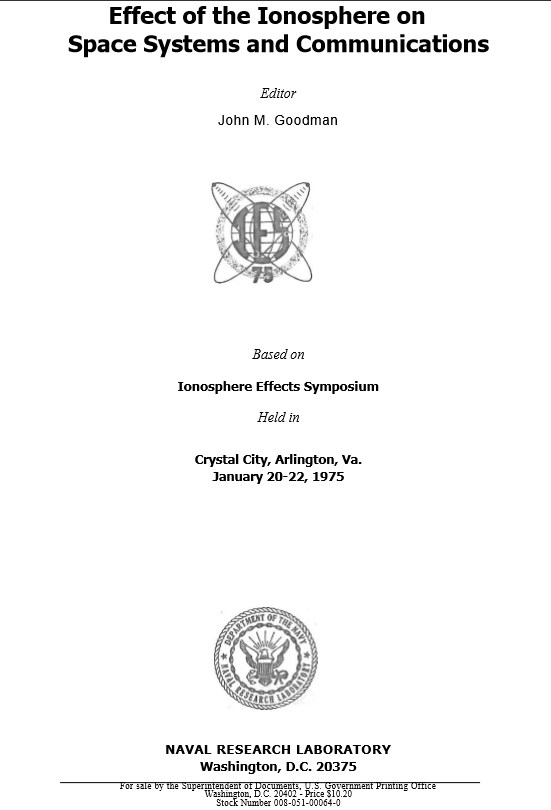
However related work was presented (on her behalf) at the Conference IES75 (proceeding front page to the left)
dealing with
travelling ionospheric disturbances (TIDs),
and compared her computed results obtained based on ray tracing method with a diverse number
of experimental studies, of which just one was her TEC studies using the geostationary satellite
ATS-1
The full IES75 paper is
here.
At AFGRL in 1974, she worked with future Institute of Navigation Fellow,
Jack Klobuchar, USAF physical
research scientist, who was developing the gamut of
ionospheric corrections
for GPS that enable centimeter precision. During her 1974 period at AFCRL she was given the task of plotting the path of radio waves emitted
by low earth orbitting satellites. The USAF supplied a civilian contractor to perform the programming for the plotting while Elizabeth
set up the actual calculation framework.
Using then extant knowlege of the (time-variable) plasma density -- the curved path of rays could
be determined as they progressed to the Earth's surface. This work - known to this writer as the
civilian programmer would regularly visit Elizabeth off-base to show latest plots -- was never
published in the scientific literature; but was used to validate satellite constellation design
for which at least 5 satellites had to be visible at (almost all) points of the Earth.
However related work was presented (on her behalf) at the Conference IES75 (proceeding front page to the left)
dealing with
travelling ionospheric disturbances (TIDs),
and compared her computed results obtained based on ray tracing method with a diverse number
of experimental studies, of which just one was her TEC studies using the geostationary satellite
ATS-1
The full IES75 paper is
here.
In 1978/9 Essex-Cohen returned to the US AFGRL at Hanscom Field as a NRC Senior Post-doctoral Research Fellow (while her husband was a Visiting Professor in the MIT Artificial Intelligence Laboratory). As in 1974 she worked with leading researcher Jack Klobuchar.
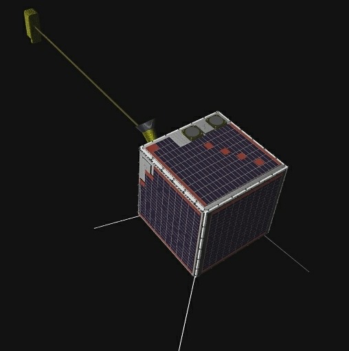
Essex-Cohen's position as a prime researcher on microsatellites at the start of the 21st century was recognised by the internation community: in fact in one nineteen months period before the launch of FedSat she was invited, and attended at JPL's expense, five separate workshops on microsatellites at the Jet Propulsion Laboratory, Pasadena. At the actual date of the launch of FedSat, Saturday December 14, 2002, she fell ill, was in hospital by Xmas. In January 2004, in a short period of remission of her cancer, she attended a Beacon Satellite Workshop in Hobart, attended by international scientists, including notably her first research student, Prof Brenton Watkins of Alaska. She died March 2004.
A sampling of Essex-Cohen's publications - with bibliographic details and abstracts, is here
Plasmasphere effects on GPS
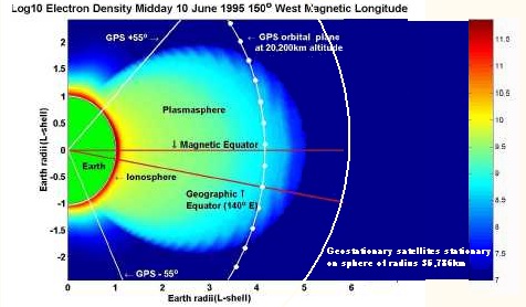 To right is a map of the ionosphere and plasmasphere
at the indicated date, from a 1999 paper by Essex-Cohen and PhD student Phillip Webb (Abstract is
here .) Note that the colour coding indicates the electron density.
Although electron density in the plasmasphere is much less than in the ionosphere, radio waves from GPS satellites to earth have to traverse
the far greater depth of the plasmasphere to reach earth.
To right is a map of the ionosphere and plasmasphere
at the indicated date, from a 1999 paper by Essex-Cohen and PhD student Phillip Webb (Abstract is
here .) Note that the colour coding indicates the electron density.
Although electron density in the plasmasphere is much less than in the ionosphere, radio waves from GPS satellites to earth have to traverse
the far greater depth of the plasmasphere to reach earth.
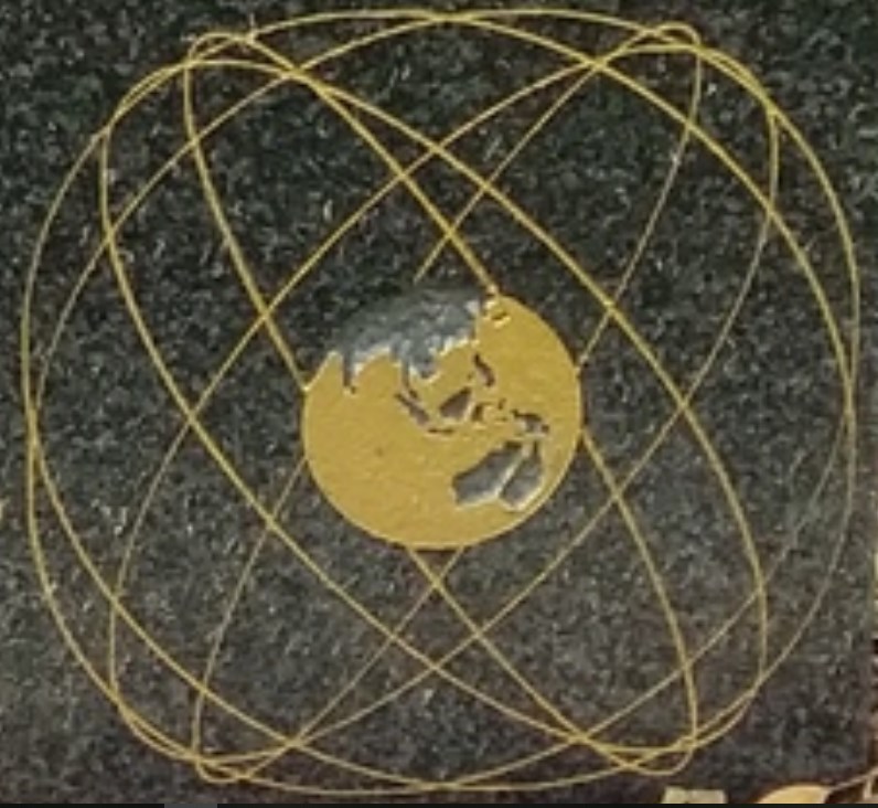 GPS orbits about the earth. To scale. Image from the granite headstone of
the grave of Dr Elizabeth Essex-Cohen.
GPS orbits about the earth. To scale. Image from the granite headstone of
the grave of Dr Elizabeth Essex-Cohen.